Niagara (ID)
Overview
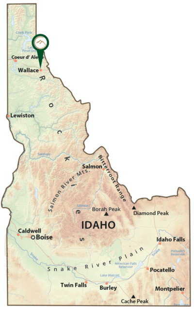
* Located in the northern part of the Coeur d’Alene Mining District, approximately 20 miles from Wallace, Idaho
* A bedded, copper-silver deposit in the Upper Revett formation
* A Plan of Operations for a resource confirmation drill program has been submitted to the U.S. Forest Service for review
Location, Access, and Description
The Niagara Project is a bedded, copper-silver deposit located in the northern part of the Coeur d’Alene Mining District near Murray, Idaho. Approximately 20 miles from Interstate 90 near Wallace, the property has good access through a network of state, county, and U.S. Forest Service roads.
Geology and Mineralization
The deposit occurs in a section of the Pre-Cambrian Belt Series in a section of mineralized Upper Revett formation near the axis of a north-south striking syncline. The western limb of the syncline has been truncated by the north-south striking Murray Peak fault, a steep, west-dipping, reverse fault.
At the Niagara project, the Upper Revett Formation consists of a light gray, massive quartzite with thin siltite interbeds. The mineralized horizon crops-out along the east fork of Eagle Creek and is approximately 30 meters below the contact with the overlying St. Regis Formation.
The deposit was discovered in the 1970’s and drilled at different periods, most recently in 2008. Past exploration drilling has been successful and has yielded sufficient data such that a historic estimate was completed by a past operator. This data resulted in a total indicated and inferred resource of 17.8 million tons grading 15.5 g/t silver and 0.39% copper. This resource estimate is not compliant with current resource estimation standards such as SK-1300.
The existing resource is currently confined to the beds of the Upper Revett formation. The favorable beds of the Lower Revett formation that host bedded copper-silver mineral systems at other regional deposits remain largely untested.
Exploration Plans
The Company has planned a drill program to confirm a compliant resource as well as potentially adding to the project in both the Upper Revett and Lower Revett formations.
A Plan of Operations for a resource confirmation has been submitted to the U.S. Forest Service for review. Past operators also calculated a higher grade, smaller tonnage deposit which the Company will investigate with its own drilling and resource modeling work. In addition to confirming the historic resource, the drill plan will explore for the strike extent of the mineralized zones which are potentially present to the east for several thousand feet and are untested.