Central Project (CA)
Overview
Location and Access
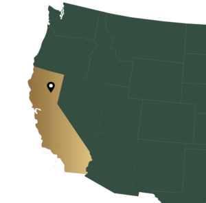
Rich Gulch is the name given to an area of placer mining that dates from the mid-1800’s during the time of the California Gold Rush. It is located at the junction of Rush Creek and the North Fork of the Feather River in Plumas County, California. Quincy, the County Seat, is located 22 miles east of the property on State Highway 70. Reno, Nevada, is 100 miles to the southeast. A total of 38 unpatented lode mining claims make up this project and are accessible by dirt road that parallels Rush Creek and climbs in elevation to the north.
There are two distinct “properties” that make up the “Rich Gulch” area and are called the RG and Virgilia properties. The Virgilia, or “Virg” claims are the area of focus for Gold Express Mines, Inc. The Virg property is located immediately north of the junction of Rush Creek Road and Highway 70. Rush Creek passes through the proposed Virg open pit.

Geology, Mineralization and Exploration Plans
Regional Deposit Types
In the western foothills of the Sierra Nevada Mountains, there are gold deposits believed to be genetically related to the intrusions of the Sierran granitic batholiths but occurring largely in the belt of metamorphic rocks. Some districts have small granitic intrusions as host rocks, while other districs have gold adjacent to serpentine bodies (Clark, 1966). There are volcanogenic massive sulfide ore bodies in the foothills, and the occurrence of gold ore bodies in sequences of altered volcanic rocks suggests that some of the gold deposits may be related to a VMS style of mineralization.
Property Deposit Type
Mother Lode gold deposits have historically been classified as being mesothermal and the result of hot, gold-bearing fluids passing through porous horizons and depositing the gold. Gold mineralization at the Central occurs within and occasionally adjacent to a sheared, dacitic flow and tuff horizon within the Cear Formation (Ford, 1988; Wright, 1945). The lack of typical quartz veins as hosts for the gold and the restriction of the gold to a tuffaceous horizon suggest that hte mineralization might be syngenetic with the tuffaceous horizon. In either case, the mineralization is tructurally and stratigraphically contained, and finding the extensions of known mineralization within these horizons should be the focus of future exploration.
The following are excerpts taken from the Central Orebody Report on the Rich Gulch Properties:
“Historically, gold was found to originate in quartz veins beneath the placer workings and underground operations to exploit the vein deposits were explored. In 1934, the Virgilia Mining Corporation was formed to explore the eastern Hallsted ground. The veins in this area are located just north of the Feather River in the area of the Virgilia property and cross the Feather River to the south. Shafts were sunk and tunnels driven along the vein to a depth of 600 feet under the Virgilia area and along the vein under the river. Production up to the time of World War II was 70,000 ounces from orebody averaging 0.22 ounces a ton. The economics of the mining operation required that substantial tonnages of lesser grade ore be left in place. Most gold mines were closed during the War and the Virgilia never reopened. In 1980, Inca Mining Corporation acquired options on claims and parcels in and around the area and began evaluating the gold resources. This included geological, geophysical, and geochemical surveys, metallurgical tests, environmental studies, economic analyses, and mining feasibility studies. A total of 241 diamond and percussion drill holes totaling 75,941 feet, were completed. With the collapse of the price of gold in 1984, Inca’s plans to mine the orebodies were terminated and over the next decade, the claims were allowed to lapse.
The Melones Fault, the main structural feature of the Mother Lode Gold Belt, is located 500 feet west of the lineral zone of quartz veins that holds Virg orebodies. West of the fault are ancient (Triassic-age_ submarine basalts that have been metamorphosed to serpentinites. East of the fault, the rocks consist of marine sediments of the Cedar Formation. These rocks strike 55 degrees north (thus the orientation of the local mine grid to this direction) and dip 55 degrees east. The Cedar Formation is also metamorphosed and consists of thin bedded slates, a dacitic flow, and minor limestone. The veins are hosted by the dacite flow and the adjacent shales. The dacite ranges from 3 to 80 feet wide and averages 35 feet. Ore-grade widths are primarily in the dacite and range from 10 to over 70 feet. Gold values in teh quartz veins and silicified zones are the same from the deepest levels of the Virgilia Mine workings to the highest surface exposures above the Central orebody, a vertical distance of over 2,400 feet. Continuity of the mineralized zone along strike is governed by the presence or absence of the dacite horizon.
Report Links